Everything you need to know about Gunung Tapak – the no.1 most accessible and secret climb on Bali
Gunung Tapak, or Mount Tapak on the island of Bali is one of the lesser known but more accessible volcano hikes in Bali. This Bali Life is going to give you all the information you need to have fun and explore Tapak safely.
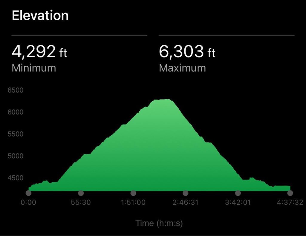
Situated in the caldera of Bedugul, Gunung Tapak rises to a height of 1909 metres (6263 ft) above sea level. Which, whilst that sounds fairly large, it is however one of the most accessible and fun climbs in Bali. Our 6 year old boy and his friend have managed it with no training and not too much complaining.
All the peaks up in the Bedugul area are “inactive” volcanoes but there is active thermal activity in the area. The whole area is actually just the remnants of a massive volcano that stood bigger than Agung. But there are no recorded eruptions in this area despite all these western peaks of Bali being considered as quite new in geological terms.
For an extra nerdy fact “Tapak” literally translates as “Flat”. So Gunung Tapak means “Flat Mountain” or “Mountain Flat”. This is simply because the profile of the top of the mountain is quite flat. Told you it was nerdy.
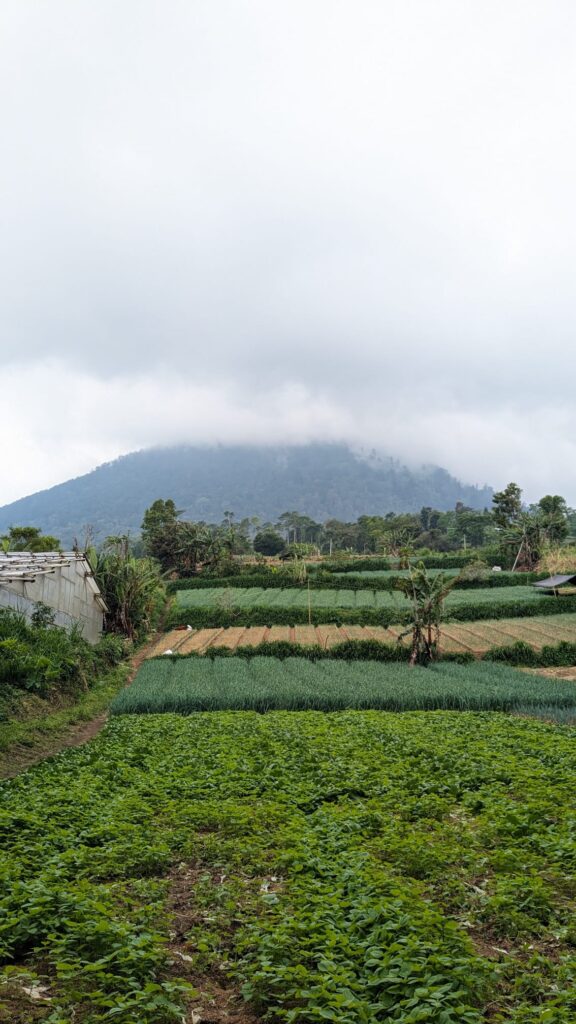
The start of the main climb up its steep slope starts in the Botanical Gardens and for that reason it is one of the best kept trails in Bali and a joy to hike on. On weekdays you are likely to cross paths with a young lad, hired by the Botanical Gardens, working to keep the trail clean and tidy. I always like to offer him a tip of anything from 10k to 100k whilst pointing at the trail and saying “Bagus” (Good!). It’s worth it to see the surprise and delight in his face.
There are a number of routes you can take and most of them take in a section of the outrageously stunning Botanical Gardens which on any day is enough to make your day a success.
To be clear though, this hike isn’t like those up Agung, Abang and Batur where you’re going to see incredible views from multiple vantage points to blow your mind. The majority of this climb is under tree cover where there are no views at all. The vegetation is wonderful, exotic and hugely interesting and for some is enough to love this trail. There is, however, a clearing just before you summit where you can see for miles across the north west of Bali depending on the weather. If you’re lucky enough to have a clear bright day it is stunning. But like anything it can’t be guaranteed.
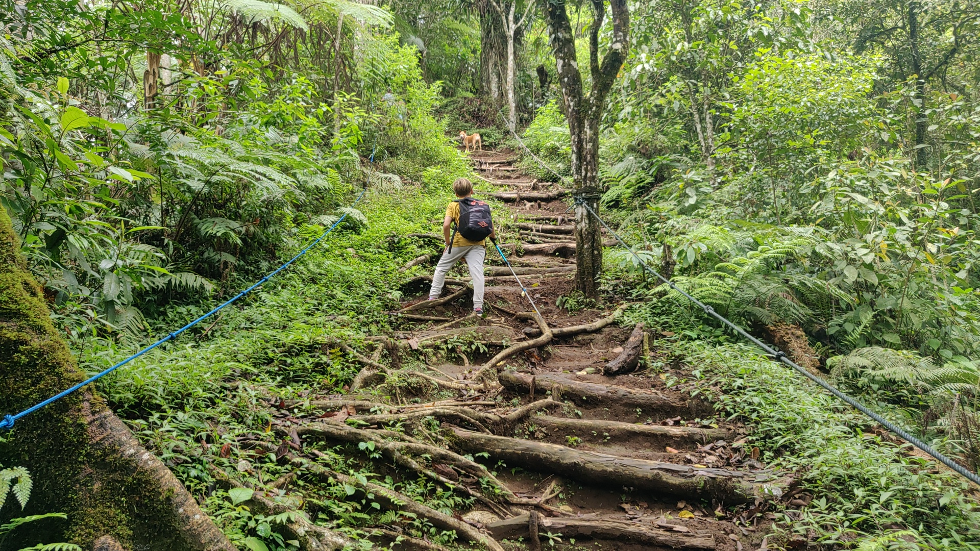
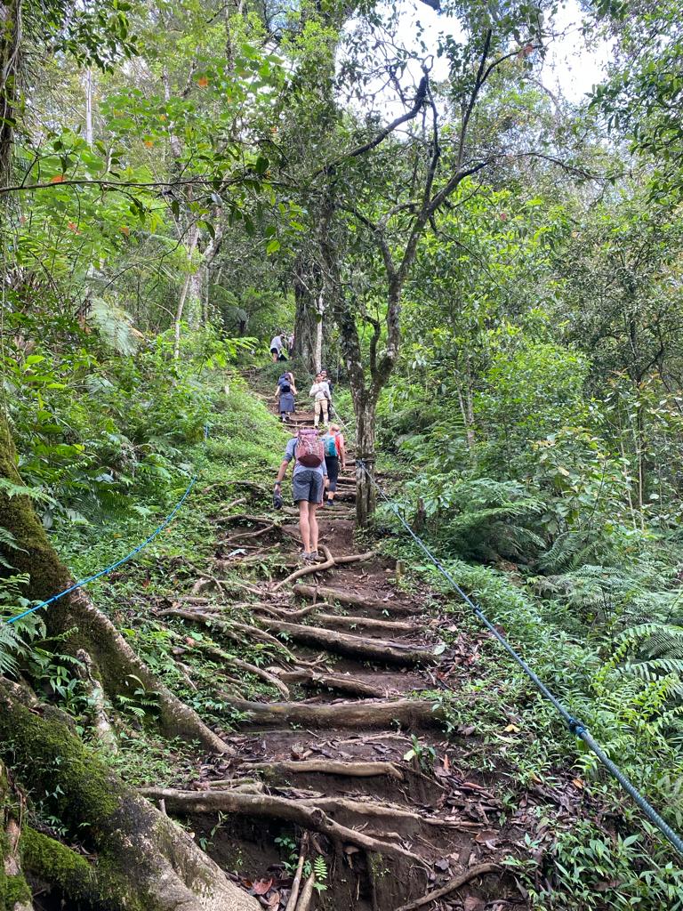
The trail is very steep and if you haven’t experienced climbing volcanoes in Indonesia it can be quite a shock to the system. Across Europe and the states we have a tendency to build switchbacks and harpins into the trail to lessen the gradient. These volcanoes in Bali don’t play like that. They often feel like someone drew a straight line from the top to the bottom and decided that’s the path. Maximum steepness all the way to the top. It can feel like going up a steep flight of stairs that are slippy and muddy all the way to the top. You’ll love it.
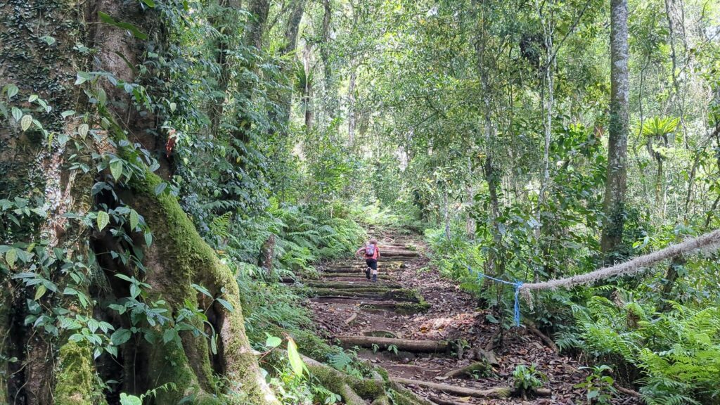
But as I’ve mentioned the trail is immaculately kept on Gunung Tapak so the extra slippy parts are roped well and a lot of the route feel like a muddy stairway, the way the roots and logs have been manicured to make climbing a pleasure.
How accessible is it?
When I say accessible I’m not referring to it being accessible to people with disabilities I’m afraid. I simply meant that compared to some of the wild and wonderful paths and volcano climbs, Gunung Tapak is the easiest and best kept trail in Bali.
If you do have access needs have a look through our list of things to do in Bali to see if there is something more suitable.
If you have 5 or 6 year old, they will be able to climb Gunung Tapak. If you’re out of shape and determined you should be able to climb Gunung Tapak too. It isn’t easy, none of the volcano hikes in Bali are. But it is doable and quite good fun.
Botanical Gardens
As mentioned, Gunung Tapak sits in the Bali Botanical Gardens, one of the most prominent botanical gardens on the island, also known as Kebun Raya Bali. Located in Bedugul, Tabanan Regency, Bali, the botanical gardens cover an area of approximately 157 hectares; the largest botanical garden in Indonesia.
The garden showcases a diverse collection of flora from across Indonesia, including rare and endangered species. Visitors can explore various themed gardens, such as the Orchid Garden, Fern Garden, and Medicinal Plant Garden. The garden also features a large collection of orchids, a lake, and stunning vistas of the surrounding mountains.
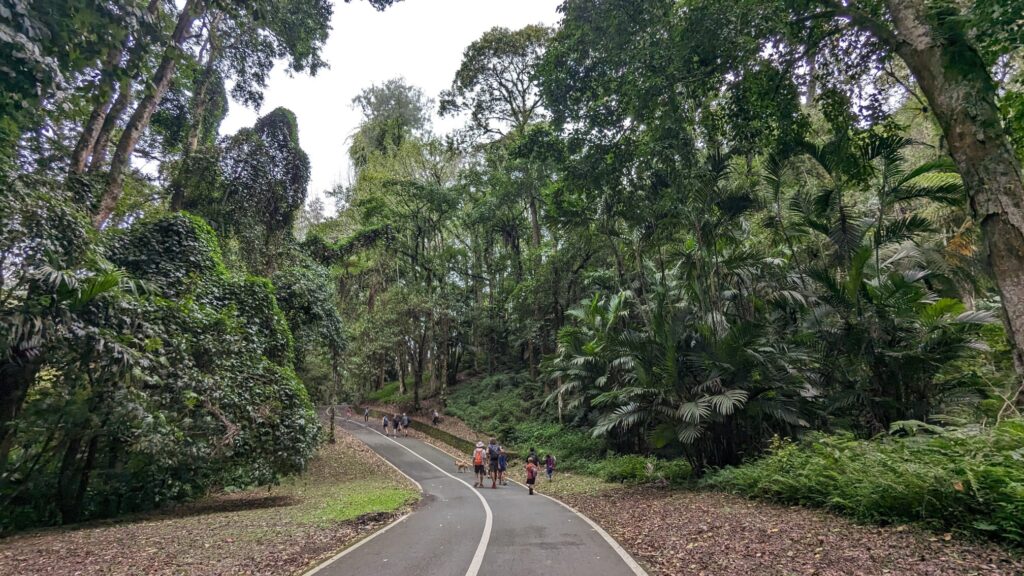
Even if you’re not hiking up Tapak you can just come here to enjoy leisurely walks, guided tours, and educational programs. The garden also offers facilities for picnics and recreational activities. Plus you can hire electric bikes and scooters and do your own tour that way. Fun stuff.
The Bali Botanic Garden plays a vital role in conserving Indonesia’s plant biodiversity, including rare and endemic species. It conducts research, conservation, and education programs to promote environmental awareness and sustainability.
Wildlife on Gunung Tapak
When trekking on Gunung Tapak, encountering wildlife such as leeches, macaque monkeys, and rats is not uncommon. To navigate these encounters safely and comfortably, it’s essential to be prepared. Firstly, wearing appropriate clothing, such as long pants tucked into socks and closed-toe shoes, can help prevent leech bites. Applying insect repellent can also deter leeches and other biting insects.
The leeches are pretty gross and very sneaky. The minute they get on you they will try to hide. I have found one under my watch before on one hike and they will often try and nuzzle into your socks. So be vigilant. They are harmless though. Just very euw.
With the macaque monkeys, it’s crucial to maintain a respectful distance and avoid feeding or provoking them. Keep any food or snacks securely packed away to minimise the risk of attracting them. If approached by a monkey, remain calm and avoid making direct eye contact. Slowly back away to a safe distance and give the monkey space to retreat.
As for the rats, they are typically more active at night but may be attracted to food scraps or improperly stored provisions. Generally though, if you aren’t sleeping at the top you shouldn’t see them. They usually make themselves scarce.
Overall, being mindful of your surroundings, respecting wildlife, and taking preventative measures can help ensure a safe and enjoyable experience while trekking on Gunung Tapak.
What to wear and what to take when climbing Gunung Tapak
Wear your sporty gear with suitable hiking/running footwear. I personally wear shorts and t-shirt with some decent trail running shoes (the Salmon Pulsar if you might ask). As suggested above some people wear long sleeves to protect against insects and leeches. I prefer to flick them off as soon as I can.
When it comes to footwear when hiking volcanoes in general it’s usually the downhills that are the real test. Choose something that fits well but is at least a size bigger for you. From experience choose shoes that are more rugged than some of these delicate options on the market these days. Gunung Tapak won’t be too much of a test for your feet but as you hit the bigger more demanding climbs your choice of footwear becomes more and more important.
And don’t forget to trim your toenails. A slightly too long toenail pushing into the box of your shoe for a multiple hours equals a bruised toenail which will eventually lead to no toenail. Speaking from experience here.
It’s definitely more muddy than rocky and it can be damp and humid in the forest so bear that in mind.
Generally, when hiking volcanoes in Bali, I have a pretty standard list of stuff that I take and recommend others to take;
- Route map on your phone – really important to keep checking to ensure you’re on the main trail
- Plenty of water. It’s better to have too much rather than not enough. I’d say a minimum of 1.5 litres per person for Gunung Tapak
- Snacks – something high in calories like nuts or protein bars. (Salty sweets are good too.)
- Light waterproof. For obvious reasons
- Sunscreen
- Insect repellent
- Money
- Hat/cap (optional)
- Hiking poles (optional)
And my top tip is to take your sandals or flip flops and a spare t-shirt to change into immediately after the hike. You’ll be thanking me when you finally take off your shoes and slip on your sandals after hiking Gunung Tapak. Keep them in your transport as your bag will often get drenched from the humidity/foliage/sweat.
General rules to adhere to on all volcanoes in Bali
Tourists have earned themselves a pretty poor reputation across Bali. Whether it’s some muppet barring his arse on Agung or some naked influencer sprawling themselves across an ancient holy tree, the Balinese have got the impression that tourists just want to disrobe and disrespect nature when in the wilds. So we’ve got some work to do.
Here’s some basic rules you should have in mind when hiking Gunung Tapak;
- Don’t take your clothes off. Really not that hard to follow.
- Leave no trace – even things like biodegradable apple cores should be taken home.
- No reckless behaviour – volcanoes are dangerous. People die on them every year. Stick to the path. Stay safe.
- Check the rules on guides – some mountains like Batur insist that you need a guide
- Check if there is a ticket to be paid – this isn’t always obvious
- Pay your respects and be respectful – every peak in Bali will have a temple at the bottom of the trail where you are supposed to ask permission to the spirits and gods of the mountain and a temple at the top. The Balinese are deeply religious and these mountains all have special significance and ancient stories associated with them. Treat them as such.
- If you have pass through a temple make sure that you are wearing appropriate attire in order to enter the temple
Which route to take up Gunung Tapak?
There are 2 main route options to take that I am familiar with. There is a third option that I have never done which is more of a loop. When I’ve completed this I can come back and give my best guidance on it. But for now I’ll stick to the 2 I know.
Choose one depending on what you’re looking for and the kilometres you want to cover;
Route 1 – The Climb from Botanical Gardens
Difficulty: Easy/Medium - 4km + 550m elevation
This route is just the main Gunung Tapak climb as is the route that you would take if you were spending the day in the Botanical Gardens.
START POINT: Link to the start point on Google maps
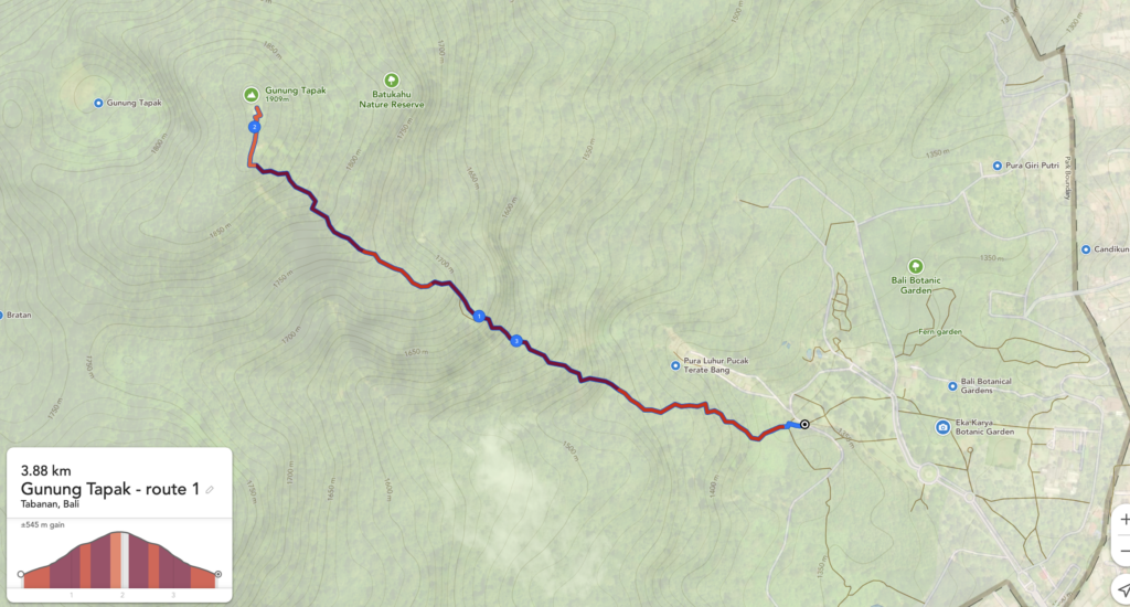
It’s pretty straight forward this route. Head to the start point and follow the path up Gunung Tapak. It’s very difficult to get wrong as the path is well kept and easy to follow. Every now and again it might seem like the path goes 2 different directions but they just loop around and will reconnect shortly further along.
On the way down just make sure you take the left to come back down the same way.
Link to an interactive map of Gunung Tapak route 1.
Route 2 – Out and back from Kampung Bingo
Difficulty: Medium/Easy - 8km + 630m vertical
As of today’s day of writing Kampung Bingo is closed for renovation but should be open again in October 2024. But you should be able to use their car park to start your hike from. There will be someone on hand to ask if you can park there. They are usually very accommodating and I will always drop in at the end of a hike up Gunung Tapak for a juice/beer/nasi/ayam.
START POINT: Start point at Kampung Bingo
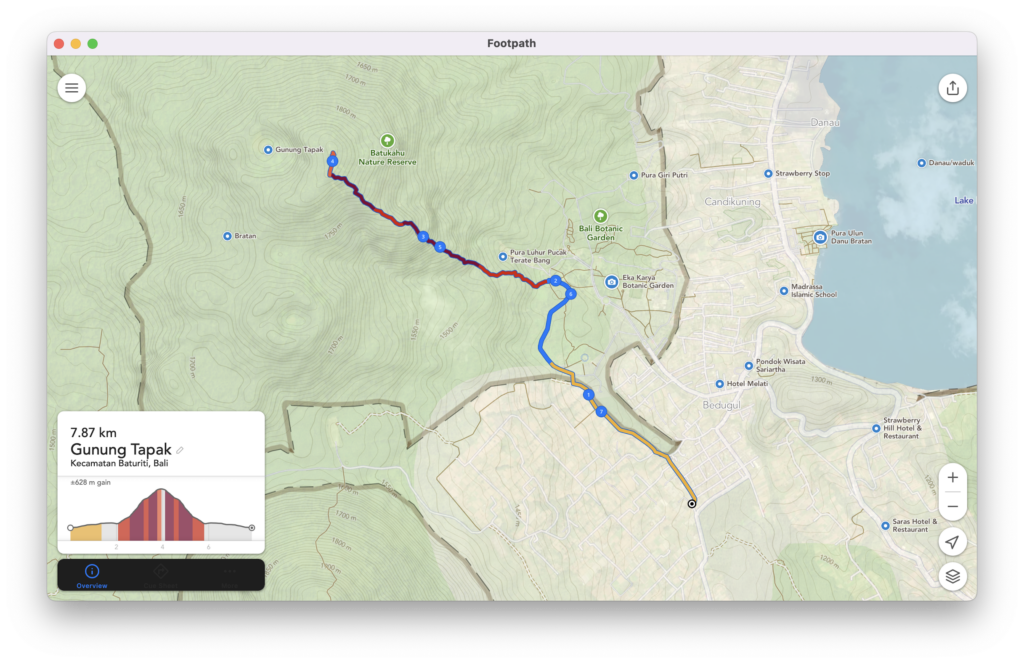
It is definitely worth having the GPX file on your phone to follow for this route up Gunung Tapak. Mostly for the approach which isn’t obvious unless you’re following the map.
Link to interactive map of Gunung Tapak route 2
Come out of Kampung Bingo car park and turn immediately left and round the corner. walk down this back road to the main road. Turn left onto the main road and follow it for less than 100 metres until you can turn right onto the farm track.
You should have a wall on your right hand side at this point. behind that wall is the Botanical Gardens. Now follow this path with the wall on your right, up the hill and across a fairly dilapidated bamboo bridge until you come to a doorway sized gap in the wall (it’s not a hole in the wall, it is a proper entrance).
Go through this gap and into the Botanical Gardens. Turn left at the road and follow round until you get to the start of the climb. You’ll miss the start of the climb if you aren’t with a guide or following the GPS. Then continue as you would on Route 1.
Once at the top head back the way you came. If you want to spend time in the Botanical Gardens please make sure you get a ticket. It really isn’t expensive.

